Luke A. Idziak


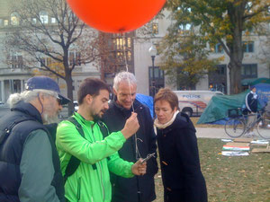
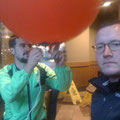
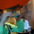
Occupy the Air: Aerial Surveillance Platform

Domestic protest movements and encampments have usually been the subjects of external surveillance and mapping efforts rather than the originators and controllers of such technology. By utilizing simple and readily accessible equipment (small weather balloons, homemade harnesses, camera phones, and fishing reels) wide angle aerial surveys for metric gathering and situational awareness are democratized and made easily and rapidly deployable. With a team led by cartographer Sam Pepple (http://samplecartography.com/), Occupy DC members were introduced to this technology/method during a day in the park and encouraged to develop and maintain their own daily floating sentry system. The first community based sky view of the camp was documented and the data used to create an augmented online map layer.